Kanu Links
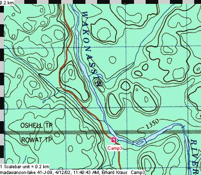
Camp 3

| Camp 3 was built in 1945, log construction, near the
Wakonassin River in Twp B (later Oshell). It served as a cutting camp and was used during
the river drives. Closed in 1962. Co-ordinates: N 5174463 m, 17 421772 m(NAD83) |
| Special thanks to Bill Blight
from Espanola, who made available the locations, photos and camp descriptions Note about the map images:
. |
Spanish Forest Lumber Camps of 1945 to 2002
Click here to get back to Erhard's
Home Page
Click here to get to Erhard's
Favorite Paddling Areas